Description
Where do you live? Where is your whānau from?
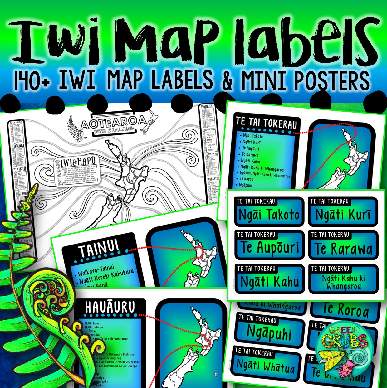
This Iwi Map labels pack is the perfect compliment to your usual map labels set, and a great way for your young people to connect to their Pepeha and share who they are.
This resource includes:
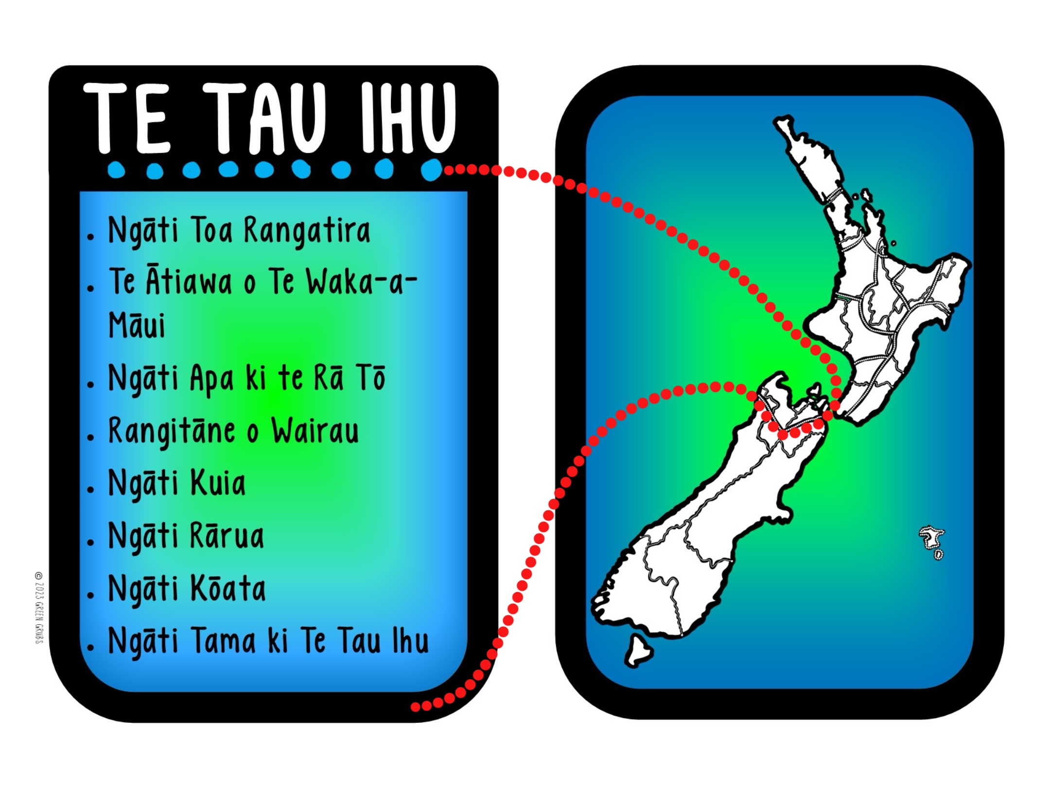
- 13 Mini A4 posters, showing Iwi grouped by region (as per the Te Puni Kōkiri website’s Iwi map) under the headings: Te Tai Tokerau, Tāmaki, Hauraki, Tainui, Tauranga Moana, Te Arawa Waka, Mātaatua, Te Tai Rāwhiti, Tākitimu, Hauāuru, Te Moana O Raukawa, Te Tau Ihu, Waipounamu and Rēkohu/Wharekauri
- Each region list is accompanied by a mini map which shows the area that these Iwi are associated with.
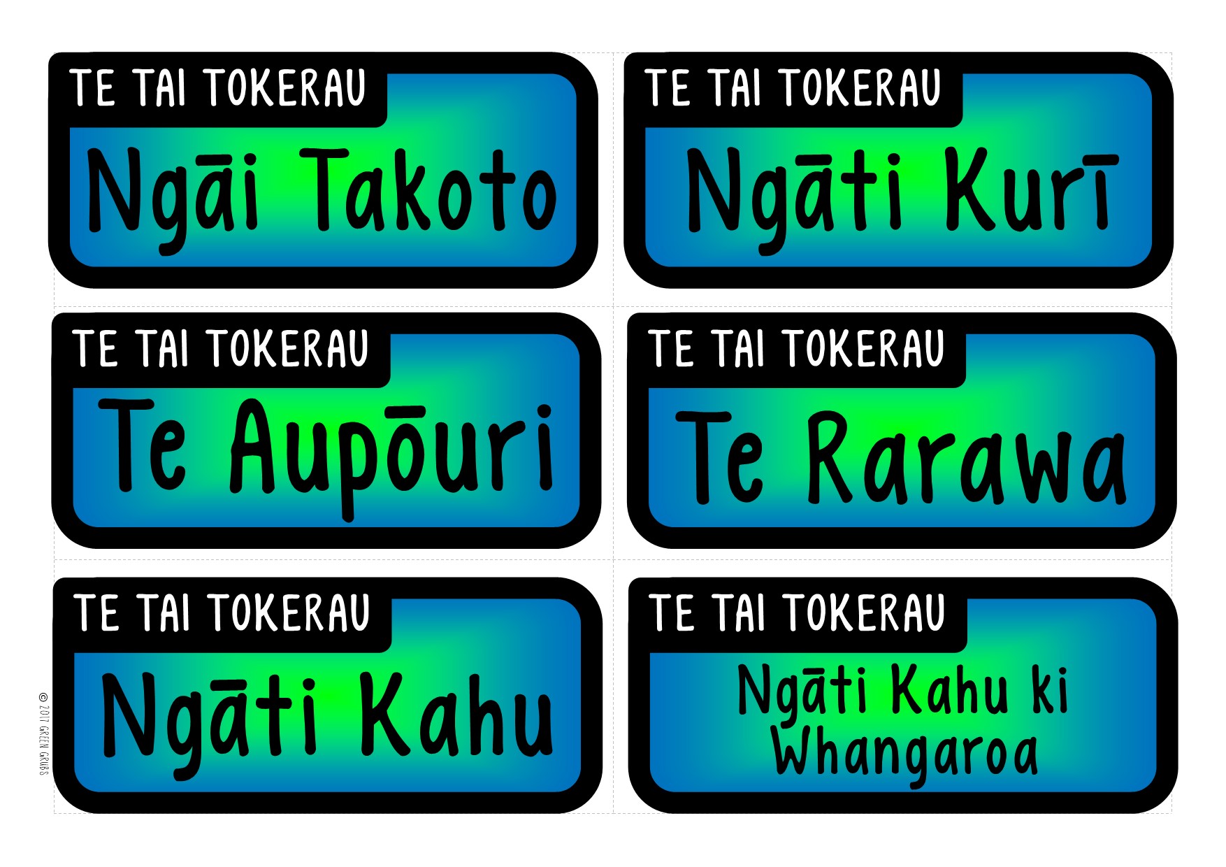
- Each Mini poster is also supported by individual labels for each Iwi (e.g. Following the Te Tai Tokerau mini poster, are smaller labels for: Ngāi Takoto, Ngāti Kurī, Te Aupōuri, Te Rarawa, Ngāti Kahu etc)
- This resource shows loose boundaries & names for main Iwi groups (clumped by region as per the Te Puni Kōkiri website’s Iwi map) Individual Iwi names are up to date as of Jan 2024. *PLEASE NOTE:* Pre-colonisation, Iwi & Hapū boundaries were fluid and intermingled. The lines on this map are only gently indictive of Iwi rohe/regions. For more information about your local area, reach out to the Kaumātua at your closest Marae.
- Use a larger map (plus further research) to identify more specific Iwi locations within each region.
A3 Map outlines are also included:
- A blank NZ outline
- An NZ map showing the boundaries for the 16 Official regions
- An NZ map showing the lose boundaries of Iwi regions (as per the Te Puni Kōkiri website’s Iwi map)
- An NZ Map showing both sets of boundaries
Match this set up with our ‘Map labels’ resource to create a full display!
Looking for more resources about Iwi groups? You might be interested in our NZ Regions & Iwi Map Collaborative Poster
Reviews
There are no reviews yet.